FROM DATA DRIVEN TO CONTEXT AWARENESS AT MAKE GEOSPATIAL MATTER 2021
INTRODUCING EMPATHY INTO THE NEXT GENERATION OF SYSTEMS
1 november 2021 – After almost a year and a half it was possible to once again organize our annual conference Make Geospatial Matter in person. While last year the event was held completely digitally, on Thursday 14 October visitors could physically participate in various knowledge sessions, keynotes and workshops and network with each other in the Media Plaza of the Jaarbeurs Utrecht. “It was fantastic to meet each other again, we missed this”, CEO Wouter Brokx said afterwards.
CAT BELLS AND CONTEXT AWARE
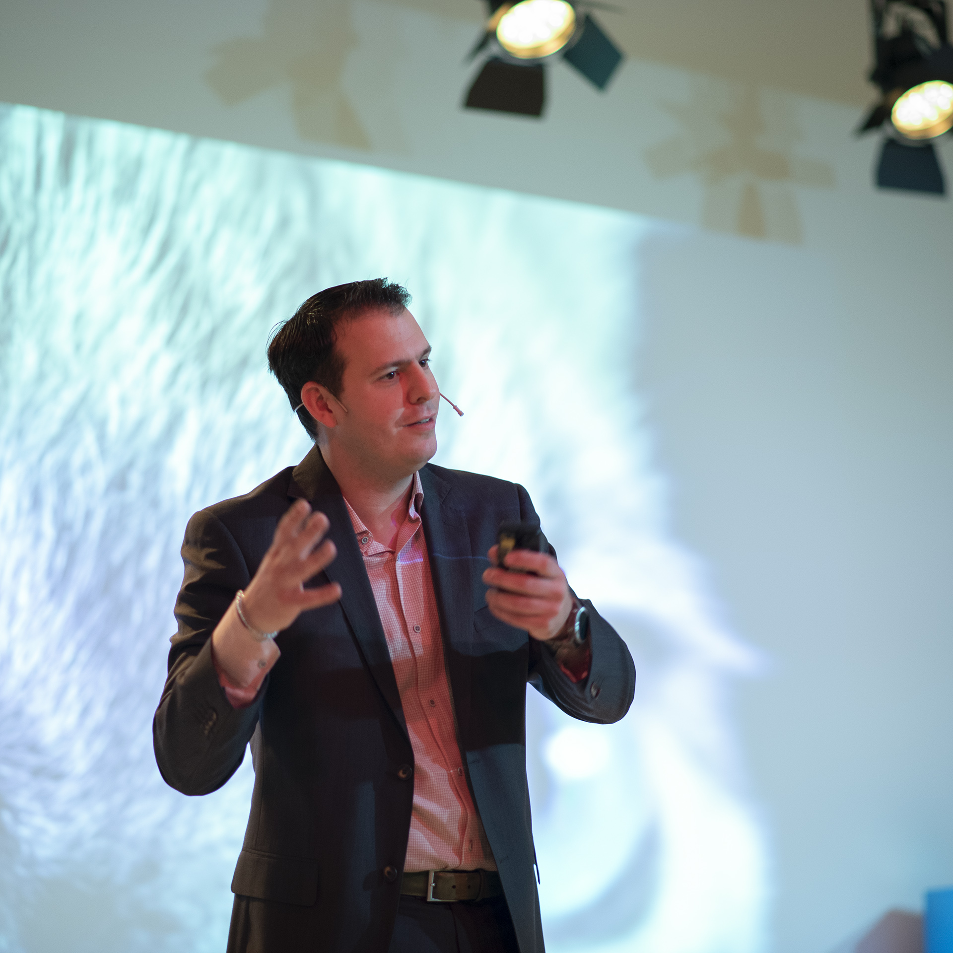
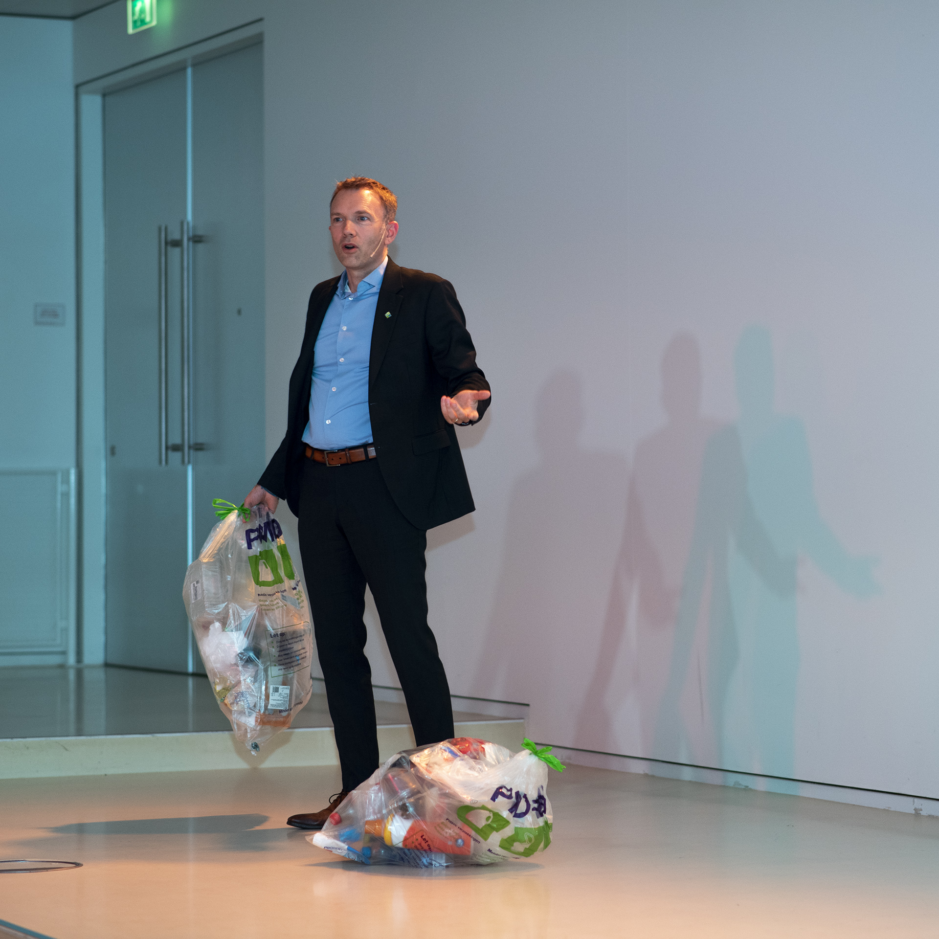
From data-driven to context-aware, that theme was central to CEO Wouter Brokx’s keynote. Being aware of your surroundings is not only very important in the world of geotechnology, but always in everyone’s life. Why Brokx was on stage at the beginning of the day with two large garbage bags of plastic waste, became clear to the visitors at the end of the day.
Bellingcat for policy: which cats do you hang your bells on? That was the topic of Martijn Zoet’s opening keynote. Zoet is a professor (lecturer) at Zuyd University of Applied Sciences and also a consultant and speaker. He is known for presenting complex subjects in an understandable way. And that was exactly what he did during Make Geospatial Matter. Everyone knows the organization of citizen journalists: Bellingcat. Among other things they investigated the MH17 disaster. The name is a corruption of ‘belling the cat’, or ‘ringing the bell’. It is derived from a classic fable about a group of mice that try to protect themselves against the attacks of a cat by secretly hanging a bell around its neck. Zoet brought this method of research into the policy field in his presentation. With his interactive and energetic way of speaking, he involved the audience in his argument. Where do you hang the bells? In other words, what exactly do you measure in order to make good policy? And do you use geo optimally for that? The audience was clearly set to think about the potential of geodata. Zoet concluded his keynote with the inspiring phrase: ‘Geo solutions are a big canvas, so throw all the paint you can on it.’
In his keynote, CEO of IMAGEM Wouter Brokx elaborated on the theme ‘from data-driven to context-aware’. Brokx: ‘In order to determine what data we need, it’s very important to give it the right context. That may sound logical to us as humans, but it is difficult for machines or artificial intelligence. To give an example: if you develop a system that has to record speeding, you have to teach the system when 60 kilometers per hour is too fast. In a residential area it’s way too fast, but on the highway it’s too slow. But there are even more variables. For an ambulance, the same speed is acceptable in a residential area, but absolutely not for a passenger car.
We humans have the ability and insight to get to the right information from that data. We can filter, just as we can during a conversation with someone in a crowded restaurant. We can filter out all the sounds around us so that we only listen to the person who is talking to us.’ Brokx’s conclusion: for good digital services, we need a next generation of systems that are adaptive through focused listening and more empathetic and understanding through context awareness.”
DIGITAL TWIN POPULAR
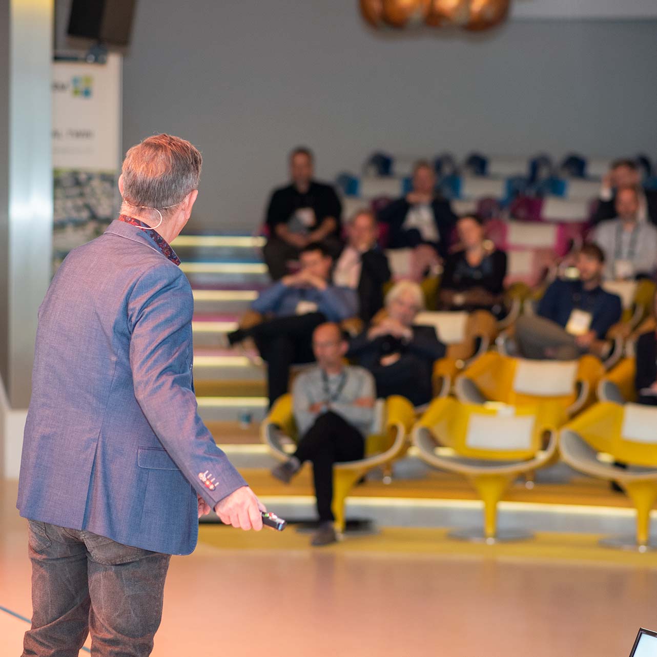
We invited customers such as (ministry of) defence, the air force, the municipality of Almere and various technical partners to share their stories during the breakout sessions. Three technical themes emerged: actionable information, data automation and digital twin. In the field of actionable information, the Dutch Royal Air Force was invited to show their solution for noise dispersion during flights. In the main hall, Joey Ermens of the Royal Netherlands Air Force enthusiastically demonstrated how they can distribute their training and transport flights across the airspace using an interactive dashboard linked to flight data. In this way, the air force gains insight into the noise pollution of their flights, which they can use to better distribute the flights and thus the noise pollution in the Netherlands.
In another room, another defense department was also talking about actionable information. Joost Michael spoke on behalf of the Geographical Service about the new geoportal for the Ministry of Defence: ‘The Geodata portal was outdated and lacked user-friendliness, which is why the Ministry of Defence was looking for a new environment. IMAGEM offered this environment, based on the APOLLO platform and the new ONEPORT environment, which ensures that Defence has a modern and fully adaptable solution at its disposal.
The digital twin theme was covered extensively this year. Visitors could follow four different sessions, including an extensive demonstration of the digital twin of Almere, a project in which ‘enthusiastic experimentation was carried out together with IMAGEM’. An up-to-date 3D model was shown in combination with various types of data, which was immediately available internally and externally for, among other things, scenario creation. Cobra Groeninzicht showed another side of the digital twin. Joost Verhagen demonstrated the influence of trees in an environment. This is done with a ‘green’ digital twin, which shows in the smallest detail what trees can do for the living environment. With this digital twin, you can see the health of the tree, how much room there is in the ground for new trees, and even when the color of the leaves changes.
Starting with a digital twin was explained by GeoBIMExperts together with the Gegevenshuis in Limburg. What was often indicated is that the term ‘digital twin’ is different for everyone, so where do you start? Together they explained to define pilots on different (sub)domains, ‘but especially to start small and step by step. As a government institution, you must always make the connection with the basic registries, because eventually these are represented in 3D.’
DIGITAL TWIN POPULAR
In the theme of data automation, automated detection in particular came up for discussion. For example, together with a number of water boards, IMAGEM has ensured that the Schouw M.App inspection solution has been extensively updated ‘to carry out the surveying of blocked waterways even more efficiently’. The solution has now evolved into a complete workflow environment, in which the entire process of digital inspection is supervised and all inspections, both behind the desk and in the field, can be handled and managed in a structured way. Even more automated detection is possible thanks to IMAGEM’s mutation signaling solution DELTA. For example, it is possible for a municipality to automatically detect solar panels. Wim Bozelie, technical director at IMAGEM, used machine learning to teach the solution to recognize certain objects and then detect them itself. At the municipality of Capelle aan den IJssel, this detection model has now been deployed and the results were discussed in detail during this session. With DELTA, the municipality has an overview of where there are solar panels and where there is still room to place more panels. This helps them to achieve their targets for sustainable energy supply.
Cleaning up plastic
At the end of Make Geospatial Matter, it became clear to attendees why Brokx was on stage that morning with two trash bags of plastic waste. After the drinks, they received a bracelet from 4Ocean, made from recycled plastic that comes from our oceans. All the bracelets combined resulted in 330 pounds or 75 full household trash cans of plastic being cleaned up. A piece of awareness to end the day.