Research & Education
Possibilities with geospatial technology are rapidly evolving. New techniques such as artificial intelligence and data science changing the way we use location-information. Research and education play a crucial role in development and usage of geospatial technology. Recognising the collaboration between business and academia, we offer education programmes from Hexagon’s geospatial division.
Looking for Internship Opprtunities?
Are you researching with Hexagon’s innovative technology to visualise and analyse dynamic information? Do you want to help users solve real-world challenges with your research project? Connect with us for internship opportunities today!
explore options
The study of geography is more than just memorising places on a map. It's about understanding the complexity of our world.
President Barack Obama
Hexagon Geospatial U
Tailor-made programmes
Benefit from a special licensing programme and community designed specifically for academia. Access a library of documentation such as complete lessons, short tutorials, examples, webcasts, a forum and more for your research and education purposes. Depending on your specific field, you can use choose the best-suited programme or combination.
Desktop Education Programme
Powerful desktop applications
Access our most comprehensive desktop solutions for remote sensing, photogrammetry, and GIS. ERDAS IMAGINE®, IMAGINE Photogrammetry, ImageStation and APOLLO Essentials suites from the Power Portfolio support a variety of curricula. The Desktop Programme is available as annual subscription bundles, including work from home licenses for your students, and as a perpetual license with annual maintenance. Power Portfolio >>

Server Education Programme
Serverbased learning
Manage all your geospatial network resources. This programme is designed for server-based solutions, for example, setting up a Spatial Data Infrastructure, a geo-catalog, workflow-driven enterprise systems and/or simply making geospatial data available via web services. APOLLO Professional, GeoMedia Smart Client, Geospatial Portal and Geospatial SDI ensure that you have all tools needed to set up organisation-wide geospatial systems. More server-based solutions >>
Luciad Education Programme
Create your own Digital Twin
Use powerful 5D technology to create real-time data in 5 dimensions on desktop, web, and mobile interfaces. The powerful Luciad analysis engines quickly process large 3D datasets for accessing and analysing. Develop your own Digital Twins and set up scenario-planning. Luciad technology is particularly suitable for students who specialize in developing solutions through programming. Luciad Portfolio >>

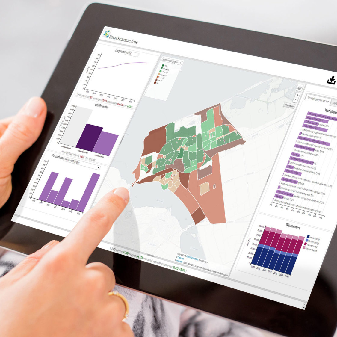
M.App ProgramMes
Plan for the future
Actionable information is the buzzwork in ICT and applies to the geospatial field. M.App Enterprise equips students with the technology to develop powerful dashboards for specific problems by combining location information, business intelligence and statistics. Interactive widgets and tools such as pie charts, graphs and timelines quickly provide deep insights into spatial problems. M.App Portfolio >>
Campus wide Grant
A stong start
Did you know that Universities can apply for a Campus Wide Grant free of charge? Get 500 licenses of ERDAS IMAGINE Essentials and GeoMedia Essenials and give your geo-education a strong foundation to build on. You can even provide your students with an additional work from home license as part of this grant for uninterrupted learning and development. Contact us to know more >>