Digital Twin with BLK2Go Handscanner
Cooperation between Leica Geosystems and IMAGEM
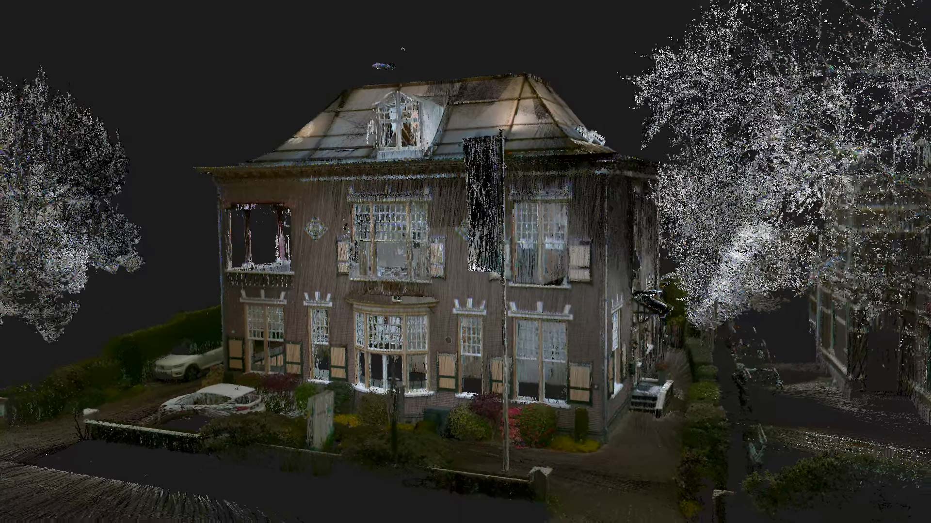
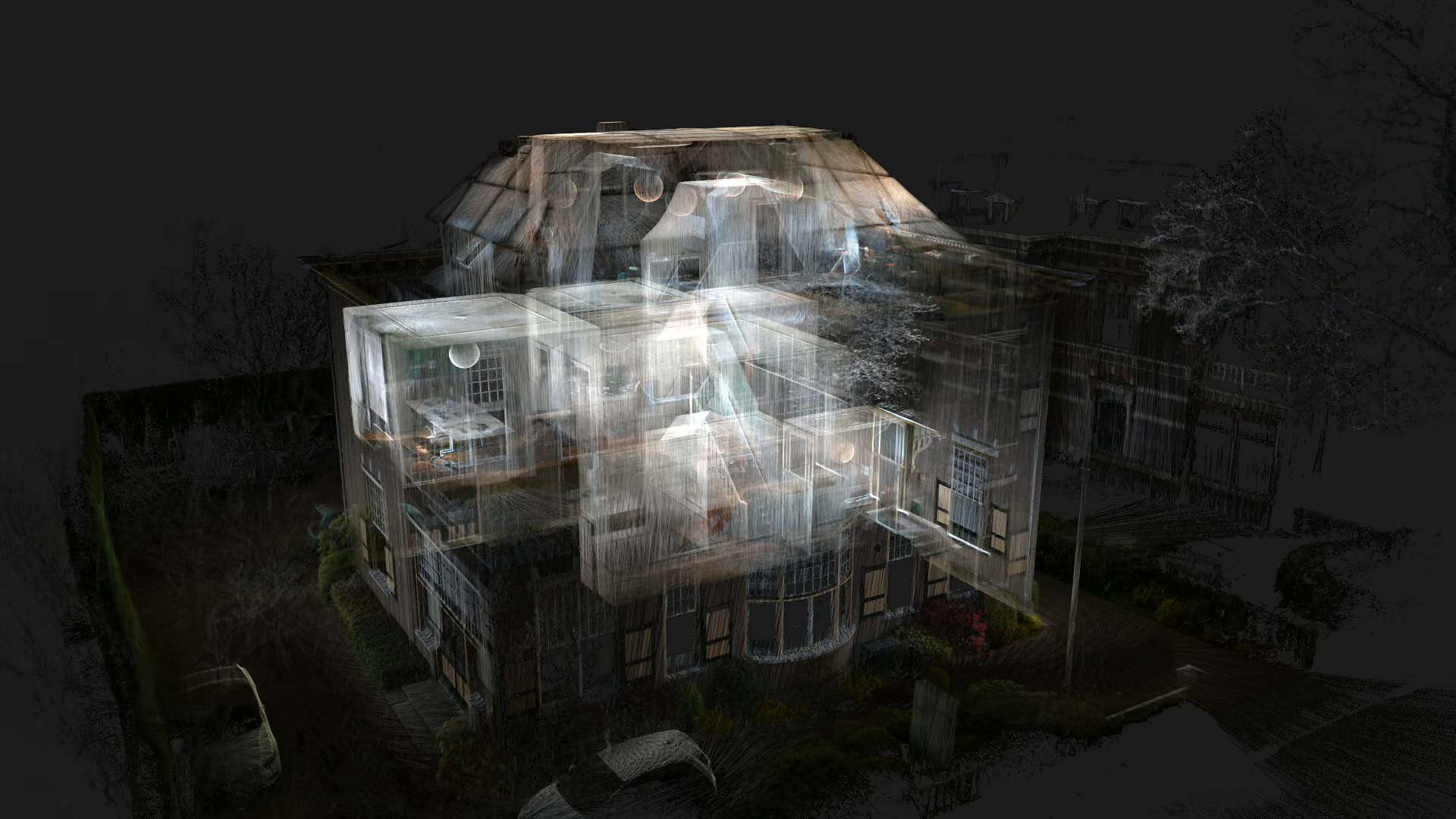
IMAGEM, in collaboration with Leica Geosystems, has made a solution available to integrate true-to-life and accurate images into a digital twin with the BLK2GO handheld scanner. Both the interior and exterior of, for example, a building can be completely captured with the scanner in just a few minutes. We demonstrate it in the video below with scans of our office in Apeldoorn.
Scans within a Digital Twin
“Colleagues from Leica Geosystems visited our office in Apeldoorn with their BLK2GO scanner,” says Patrick de Groot of IMAGEM. “It’s a handheld scanner that can scan an entire building in mere minutes in very high resolution. We use this kind of data in our digital twins, allowing us to integrate that data one-to-one into the map of the outdoor space.”
“Our clients can also integrate this kind of data into their digital twin, and it helps them get as realistic and accurate an image as possible of their buildings that they want to include in their digital twin without it taking a lot of effort. For example, they can use that data to determine volumes, the area, but also to establish escape routes in their building.”
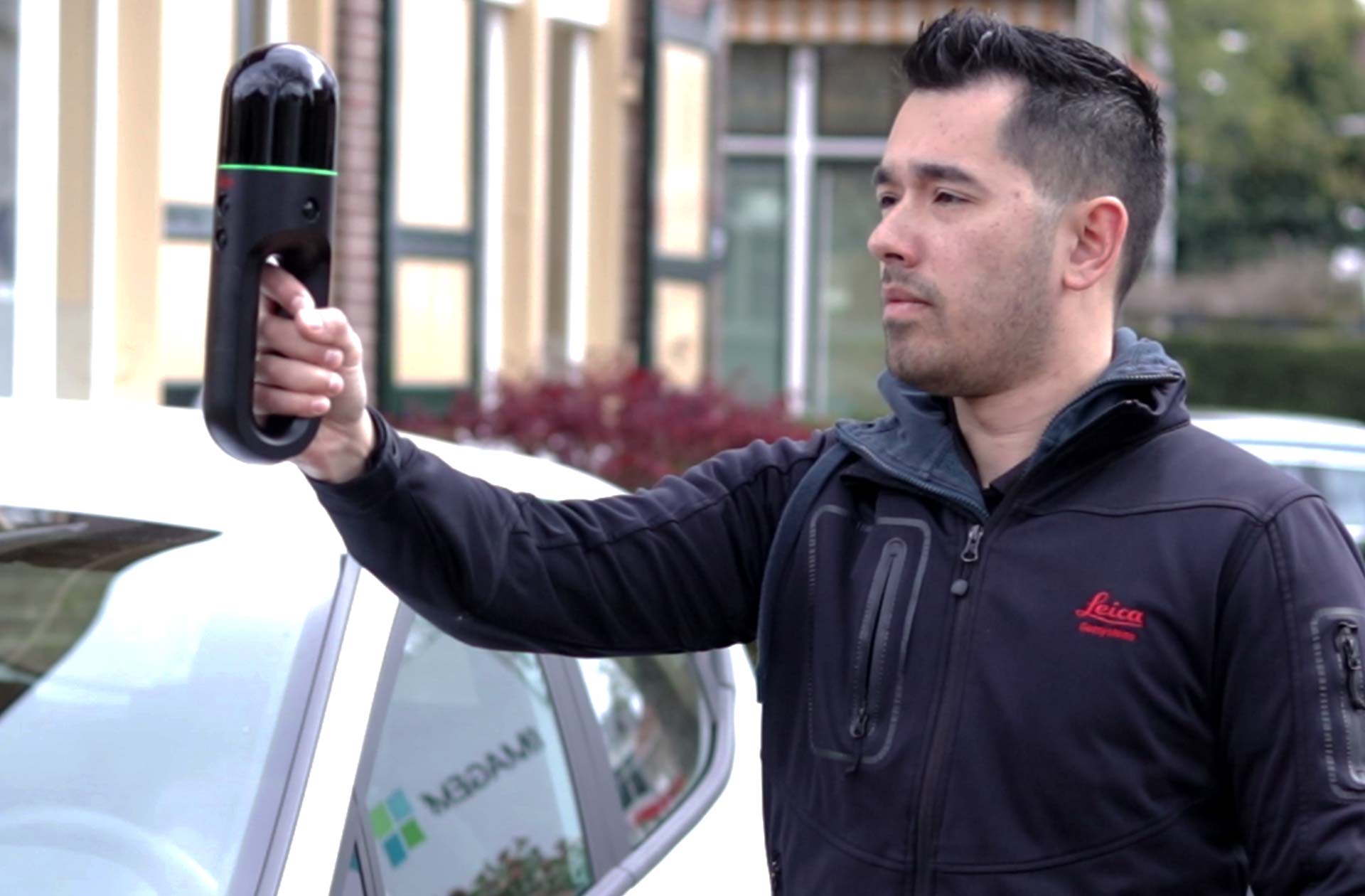
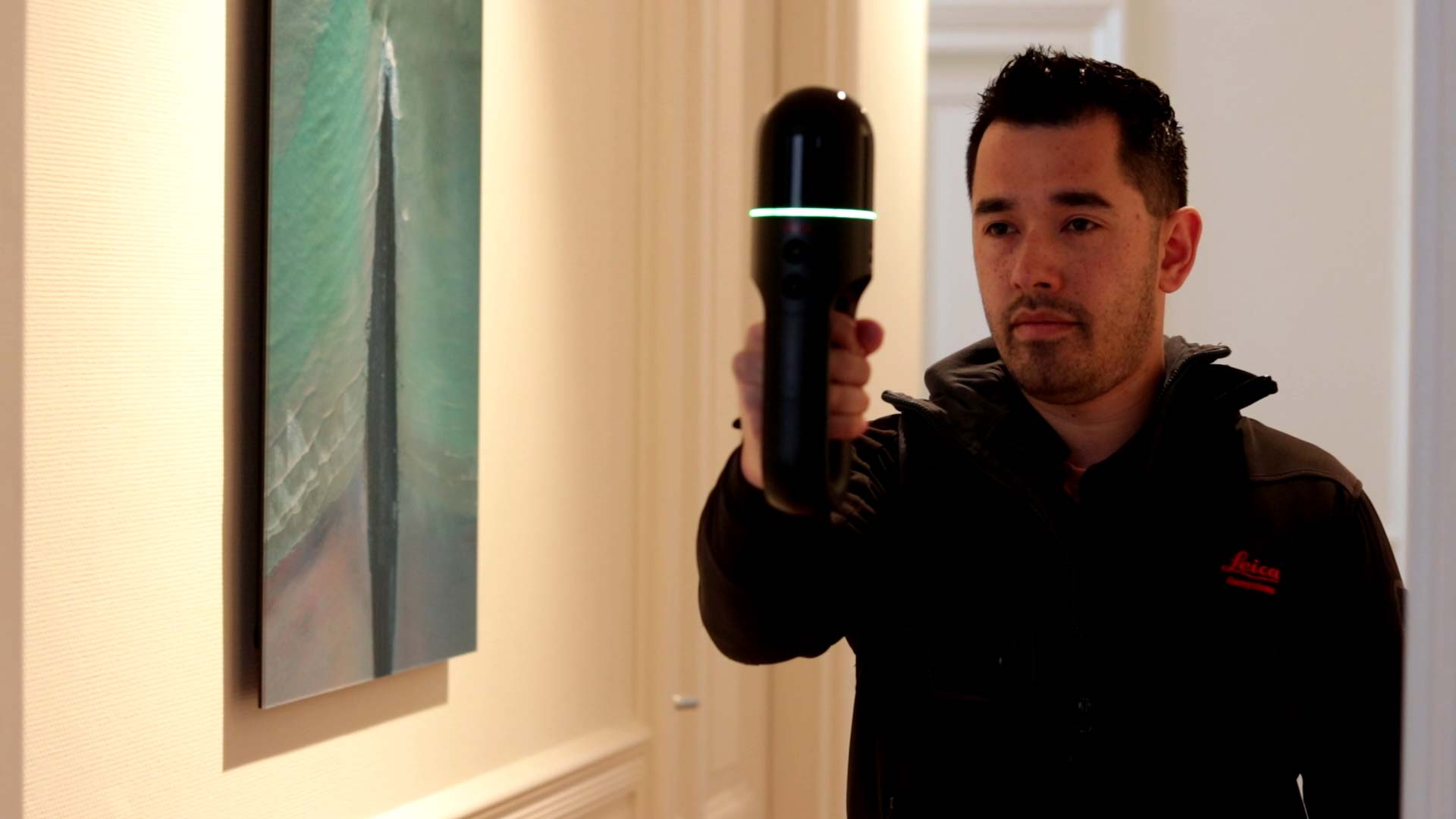
The Leica BLK2GO is not just any portable imaging laser scanner. Scan while you walk, without interruptions. As you move through a space, the BLK2GO uses advanced SLAM technology to accurately track movements and create images and point clouds in real-time with dimensional precision.
Plenty of applications
For the business and government market, this offers countless application possibilities. Companies can scan their commercial buildings to create accurate digital twins, with which they can more effectively manage maintenance, space optimization, and redesign plans.
Architects and contractors can scan construction sites to obtain precise measurements, monitor progress, and identify any deviations from the original design. Retailers can use the scanner to optimize store layout, with the digital twin assisting in analyzing customer movements and the effectiveness of shelf arrangements.
Event organizers can scan event venues to optimize the layout, improve the flow of visitors, and minimize safety risks. Real estate agents can create detailed 3D representations of properties for potential buyers or renters, making virtual tours possible that are much more realistic and immersive than traditional photos.
Our customers use this kind of data to fully integrate into a digital twin and this helps them to create an accurate as possible image of the individual buildings within a digital twin.
Patrick de Groot, Sales Director IMAGEM
Hexagon family
With this BLK2GO handheld scanner, it is possible to calculate volumes, areas, and accurate measurements of the interiors and exteriors of buildings and locations. This handheld scanner is offered by Leica Geosystems, which, along with IMAGEM, is part of the Hexagon family.
Leica is responsible for the hardware component of this solution, and IMAGEM handles the software component for integrating the data into a digital twin.